Drone Roof Inspection in Chattanooga, TN
Drone Roof Inspection starts with roof evidence before repair, restoration, recover, or replacement decisions are made.
Roof Work
Document the roof before choosing the scope
See The Whole Roof Without Walking It
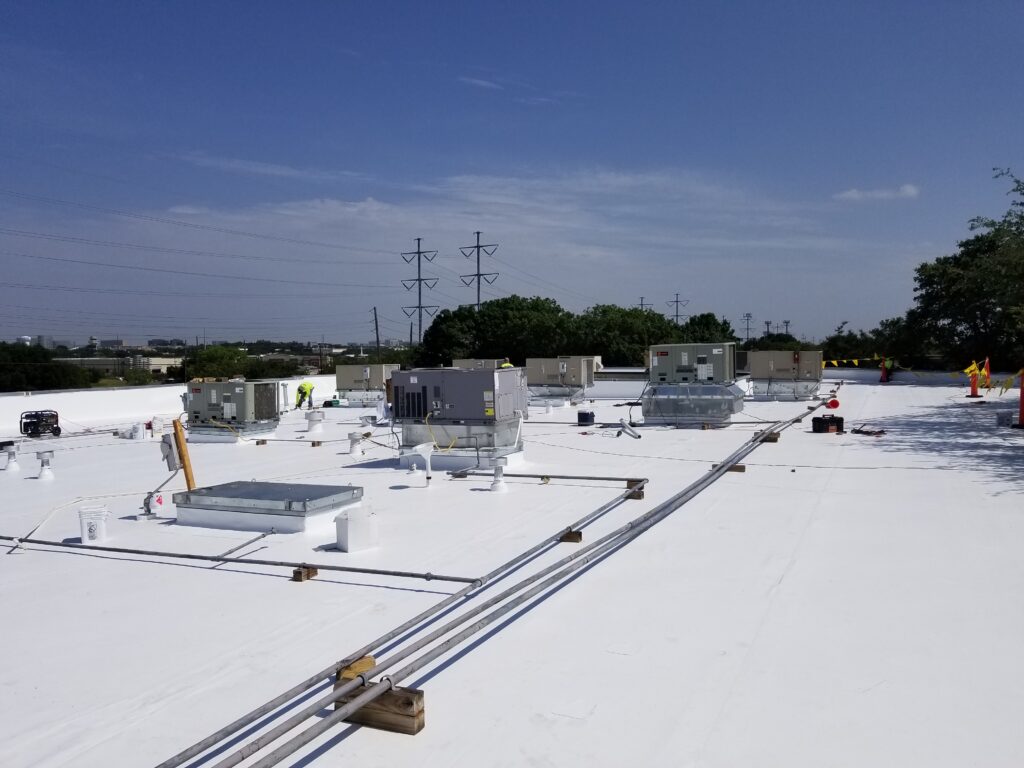
The biggest commercial roofs in Chattanooga are also the hardest to inspect on foot. A distribution building out at Enterprise South near the Volkswagen plant or a logistics roof off Bonny Oaks Drive can run several acres of low-slope membrane, and a person crossing it for hours sees a fraction of the surface, misses the ponding areas that only read from above, and leaves scuff traffic on the membrane while doing it. We fly these roofs instead. A drone carrying a high-resolution camera and a radiometric thermal sensor covers the entire surface on a planned grid, at a consistent altitude, and brings back a complete record without putting a crew on a roof whose condition we have not confirmed is safe to stand on yet.
We work this way across the buildings that fill Chattanooga's commercial corridors — the retail and office stock around Hamilton Place and the Gunbarrel Road belt, the riverfront and Innovation District properties near the Tennessee Aquarium downtown, the suburban employment centers in Hixson and East Brainerd, and the older manufacturing rooftops along Amnicola Highway. On any of them, the aerial pass gives an owner a full picture of drains, seams, penetration flashings, and surface condition in a fraction of the time a manual survey would take, and it gives us a baseline we can fly again next year and compare.
Thermal Imaging Finds Moisture The Surface Hides
The most valuable thing a thermal pass produces is a map of moisture trapped inside the roof assembly, and that is the finding that drives the most expensive decisions an owner makes about a roof. Wet insulation holds the day's heat longer than the dry insulation around it. After sunset, as the roof radiates that heat back out, the saturated zones stay warmer and show up as bright signatures in the infrared image while the membrane surface above them can look completely intact. We fly the thermal survey during that cool-down window, when the contrast between wet and dry is highest, and then confirm the flagged zones with physical core cuts so the moisture map is verified, not assumed. That single survey is what separates a targeted repair-and-recover scope from a full tear-off.
These are commercial drone flights, and we treat them that way. Our pilots operate under the FAA's Part 107 rules, we check airspace before every flight, and Chattanooga has real airspace to respect — the Class C shelf around Chattanooga Metropolitan Airport at Lovell Field reaches across a good part of the metro, and downtown and riverfront sites sit close enough that some flights need authorization through the FAA's LAANC system before we launch. We handle that clearance, keep the aircraft in visual line of sight, and plan around people and traffic below. The point of flying is to keep crews off an unverified roof and out of harm's way; doing it without the airspace and safety discipline would defeat that.
Documentation A Claims Adjuster Can Use
After a hail or wind event, the aerial record becomes claim evidence. We produce a GPS-tagged photo set that locates and counts hail impacts, shows wind-displaced membrane and lifted edge metal, and documents damage to rooftop equipment, in a format commercial property adjusters are set up to review remotely. Tying each image to a coordinate on the roof means the adjuster can see exactly where a finding sits rather than working from loose photos. For storm-driven claims we prioritize the flight, and we can usually turn the documentation package around quickly so the claim is not waiting on us.
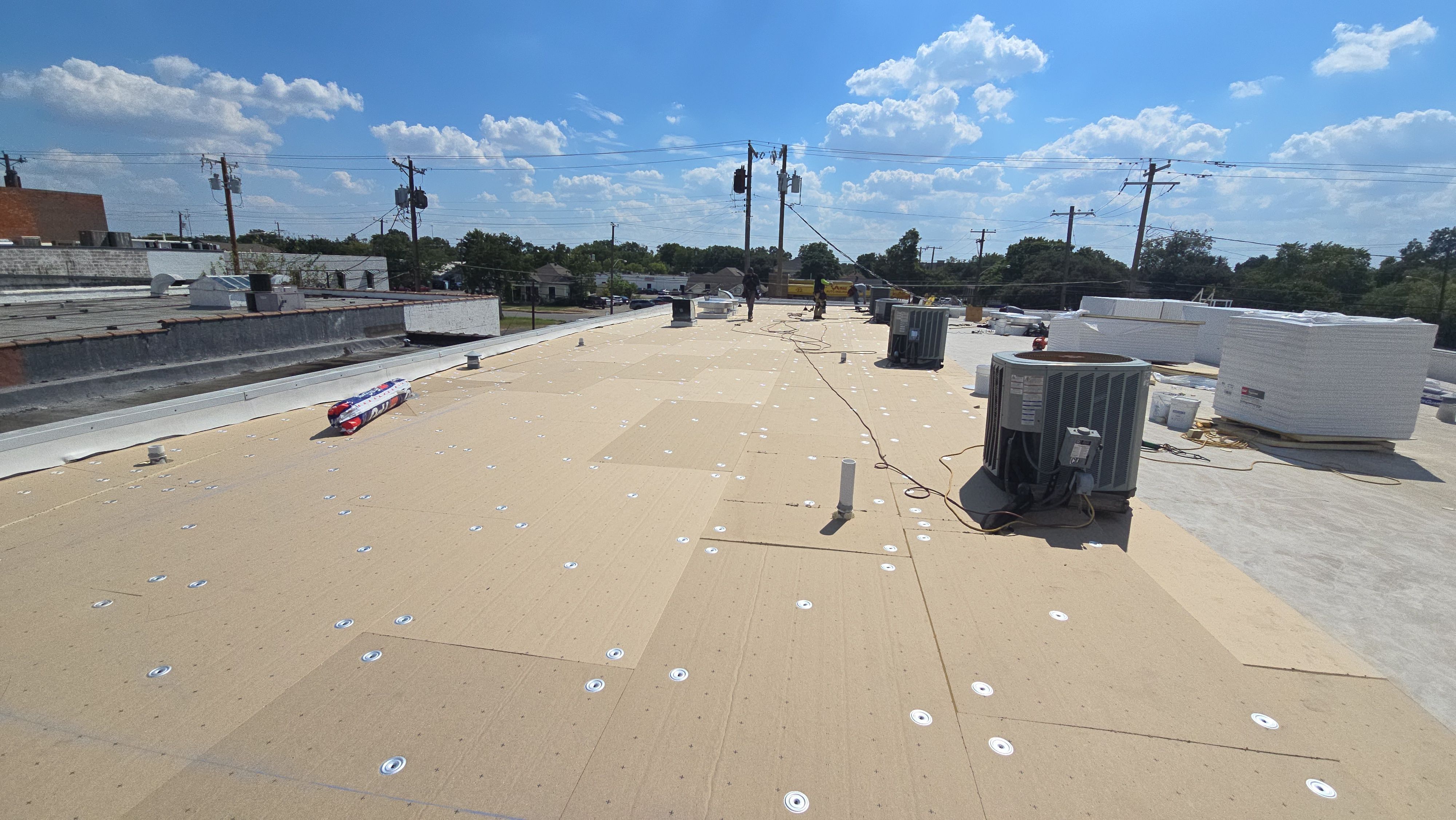
Better Drawings Before A Reroof
Before we or anyone else builds a reroofing proposal, the aerial survey nails down the things that drive cost and change orders. It confirms the roof area, locates every penetration and curb and drain, and records existing conditions as the basis for the specification. When the drawings reflect what is actually on the roof instead of assumptions from a quick walkover, there are fewer surprises during construction, fewer requests for information, and fewer change orders once the crew is on site. The same dataset feeds a capital plan, letting an owner with multiple buildings rank roofs by condition and budget the worst ones first.
Drone inspection pays off most on large, flat commercial roofs — logistics and industrial buildings, retail centers, office complexes, and multi-building campuses where coverage and trapped moisture are the real questions. On a small or steeply pitched roof, a hands-on inspection is fast and complete and the drone adds little. For any commercial roof where a full condition assessment matters and foot traffic is a liability, the aerial and thermal approach is simply the more thorough and lower-risk way to do it, and it gives us a record we can stand behind.
Drone Roof Inspection Questions
How does a drone inspection compare to a traditional walkover?
It covers the whole roof on a systematic grid at a consistent altitude and produces a complete photographic record without the foot traffic that scuffs membranes and creates liability on an unverified roof. On a large roof a walkover takes hours and still misses low spots where ponding only reads from above. Thermal moisture mapping in particular is not practical on foot at scale — it needs the systematic aerial coverage a flight provides.
Can thermal imaging really show where moisture is trapped?
Yes, under the right conditions. We fly the thermal pass during the cool-down period after sunset, when wet insulation holds heat longer than the dry insulation around it and shows up as a distinct warm signature in the infrared. The moisture map from a proper thermal survey is accurate enough to drive the repair-versus-replace decision, and we confirm flagged zones with core cuts before anyone commits to a scope.
Do you have to clear the flight with the FAA in Chattanooga?
Our pilots fly under Part 107, and downtown, riverfront, and other sites near Lovell Field sit inside controlled airspace where we obtain LAANC authorization before launching. We check the airspace for every job, keep the aircraft in visual line of sight, and plan the flight around people and traffic on the ground.
How do you turn drone footage into an insurance claim?
We produce a GPS-tagged report that locates hail impacts and their density, maps wind-related damage and lifted edge metal, and documents equipment and flashing damage, formatted to match what commercial property carriers expect. It is ready to hand to the adjuster, and because every image is tied to a coordinate, contested findings are easy to locate on the roof.
How soon can you schedule a flight?
Routine inspections are usually schedulable within a few business days. After a significant storm we prioritize claim-documentation flights and can often get up much sooner, weather and airspace permitting. We confirm the specific turnaround when you call.
Planning checkpoints
From urgent response to responsible scope
Condition
Drone Roof Inspection work starts with the affected roof area, water path, membrane condition, and interior evidence.
Operations
Work windows, tenant protection, loading paths, and safety expectations need to be named early.
Options
Repair, maintenance, coating, recover, and replacement should be compared without blurring the tradeoffs.
Next Step
A concise field record helps ownership decide what needs immediate action and what belongs in planning.
Related roof paths
Keep exploring
 Roof Work
Government and Municipal Building Roofing
Government and Municipal Building Roofing support covers access, staging, drainage, and roof traffic for Chattanooga commercial buildings.
 Roof Work
EPDM Commercial Roofing
EPDM Commercial Roofing support covers tenant communication, rooftop equipment, and dry-in timing for Chattanooga commercial buildings.
 Roof Work
New Construction Roofing
New Construction Roofing support covers moisture review, edge conditions, and practical budget timing for Chattanooga commercial buildings.